We appreciate your interest. Let’s explore beyond the surface!
For who
We have not limited the use of the application to a specific professional field, any field that needs a map view and scheduling will certainly succeed. Try planning your own sailing trip in Zeitmaps…the only limit is your imagination.


Construction:
Manage project timelines, allocate work, and coordinate tasks based on location.
Facility management:
Schedule and follow maintenance tasks
Event Management:
Plan and schedule events, considering the logistics and timelines associated with different venues.
Urban Planning:
Coordinate city development projects, considering spatial and temporal aspects.
Forestry:
Plan and manage logging operations, conservation efforts, and fire prevention activities in different forested areas.
Users
The user group of Zeitmaps consists of various types of project types in the construction industry. Zeitmaps have been used in projects for bridge construction, tunnel construction, railway and tram line work, industrial construction and for projects targeted for schools, leisures, housing constructions, brand new or renovation construction. The user base consists of municipal projects and private builders, site managers, regional builders, coordinators, traffic planners, infrastructure designers, project managers, and a large number of subcontractors and site staff covering the project. Of course Zeitmaps use is not limited, it has also been used, for example, in time and sea route planning for sailing so suitable for business and pleasure use.


Provided values
Traffic planning
Value: The app can provide area based real-time traffic information, help optimize movement and support traffic planning.
Applicability: Improving traffic safety, managing congestion and optimizing transports can be part of city projects.
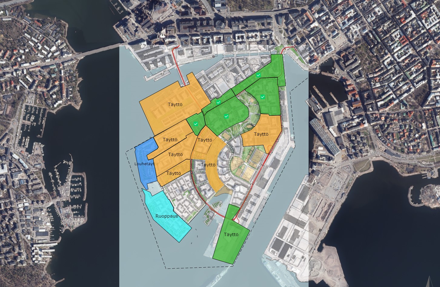
Urban planning and development
Value: The app helps visualize plans, share information about the urban structure and facilitate interaction with internal stakeholders and city residents.
Applicability: City planning, resettlement, infrastructure projects and urban development benefit from the visualization and real-time sharing of information provided by the Zeitmaps app.
Development of areas
Value: The app can help market neighborhoods, introduce regional businesses and attract residents. The service can be used as a source of communication.
Applicability: Regional development projects and supporting local business.
Involvement of stakeholders
Value: The app provides a platform for various developers, from house construction to land construction and community engineering to subcontractors, a platform to participate in decision-making and share information about their environment and plans.
Suitability: For coordinating work to minimize scheduling challenges with urban projects and decision making.
Visualization of information
With the help of maps and schedules, the user can more easily identify and understand work areas, information and make decisions.
Features
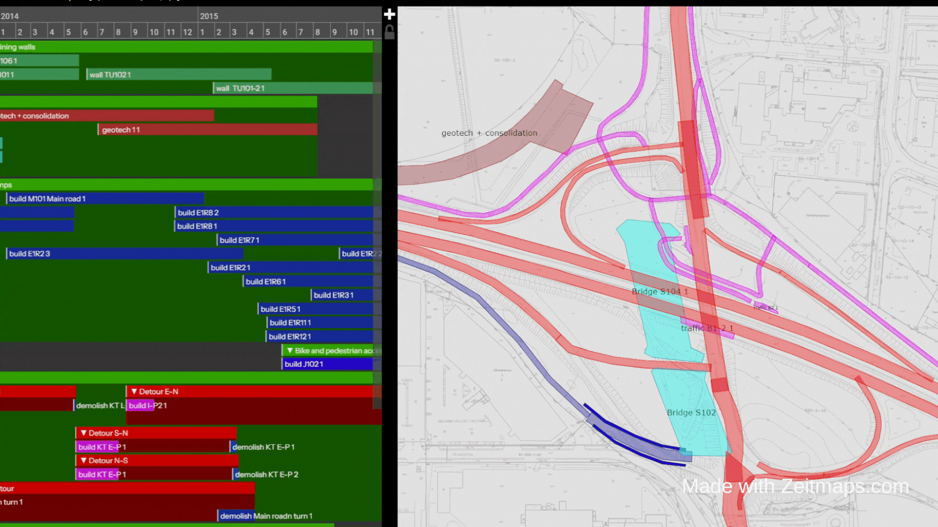
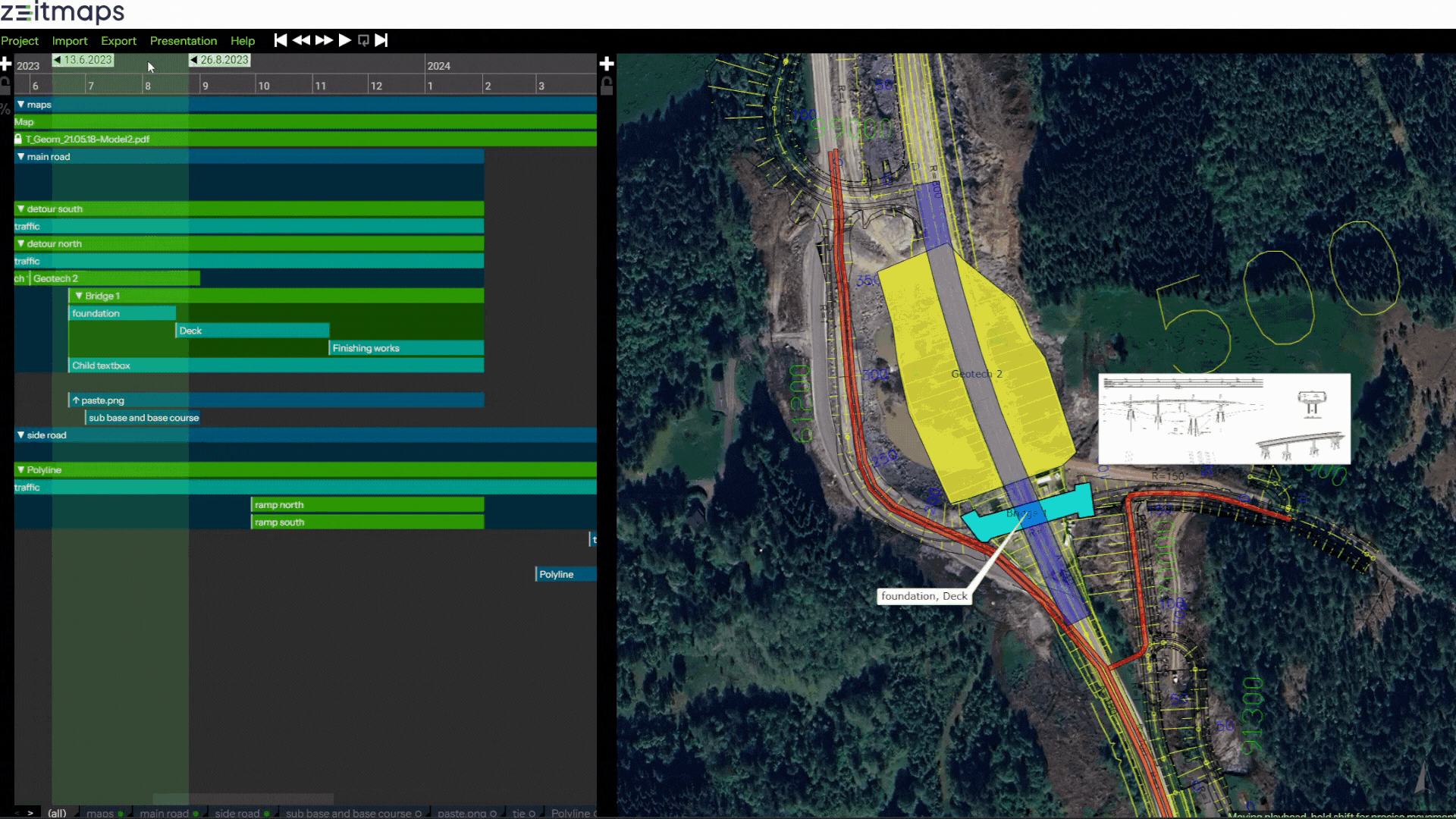
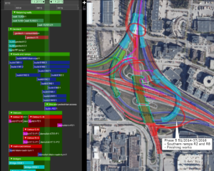
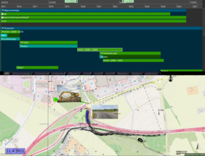
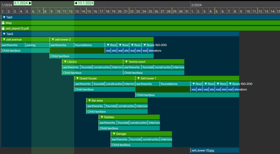
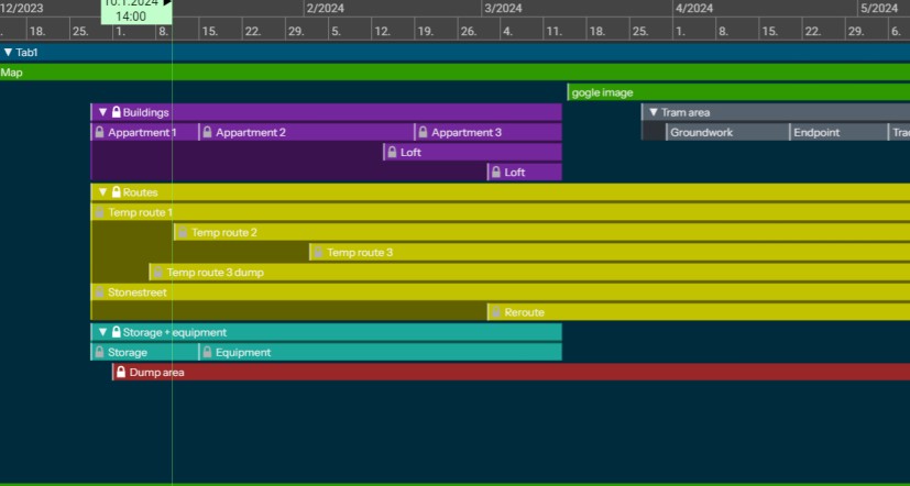
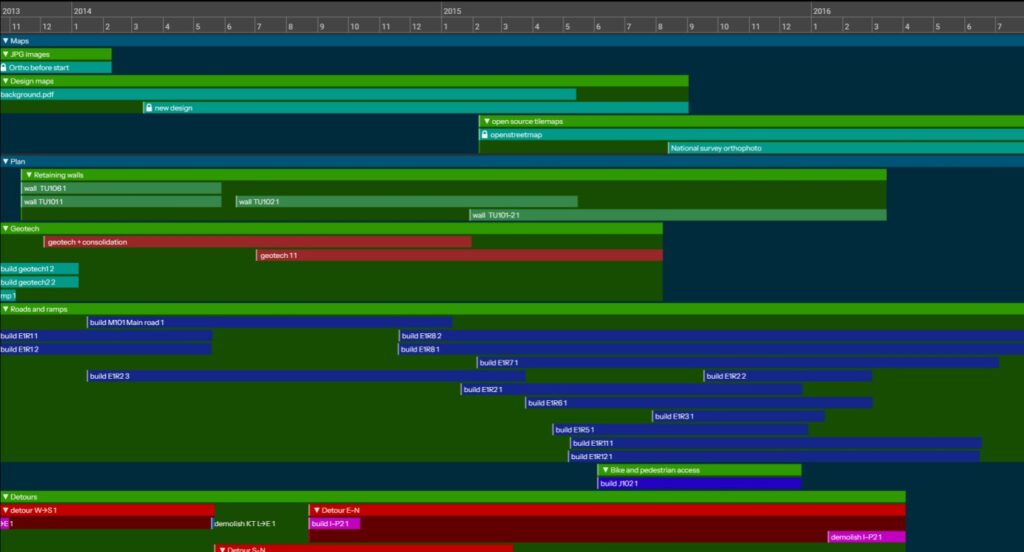
Gantt view
In gantt view, item timings can be edited as in project management software. Items can be added and edited in the view or imported from MS Project or Excel. Item hierarchies can be created and items can be sorted in multiple tabs. Calendar work week can be customized.
Task completion degrees can be tracked in the gantt view.
You can select a time or time range in the gantt view timeline, and the map view will display the state of project for the selected time.
Time precision for a project can be customized. You can operate on minute -precision times or use more rough time precision from hours or days up to centuries.
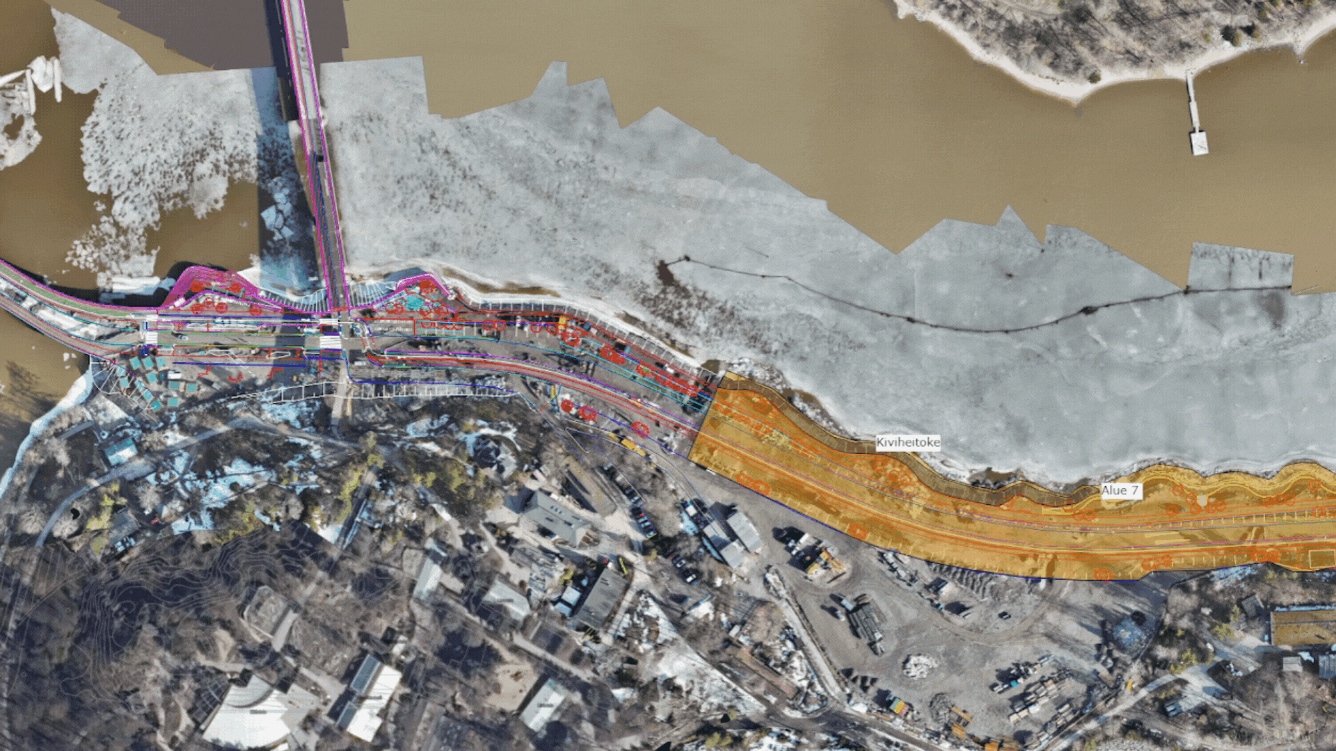
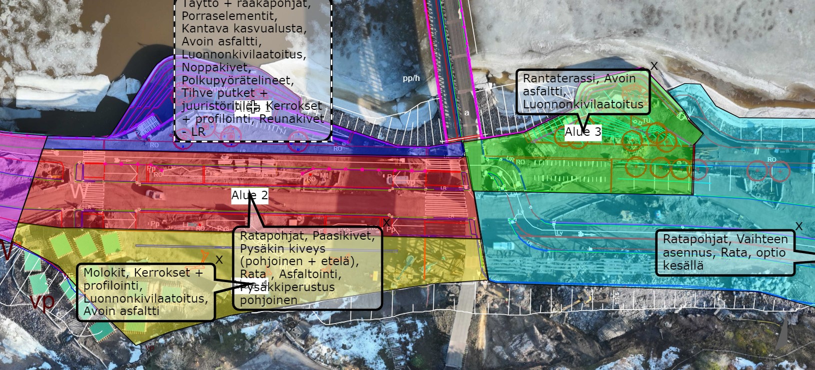
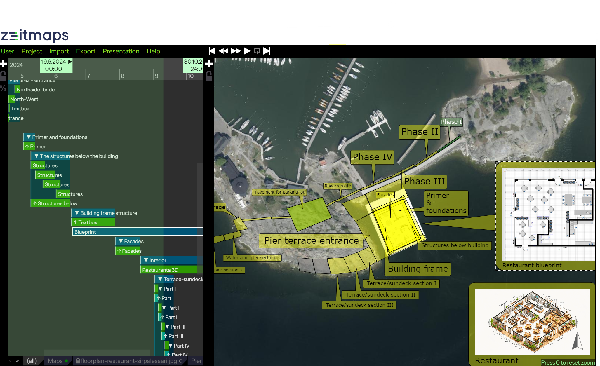
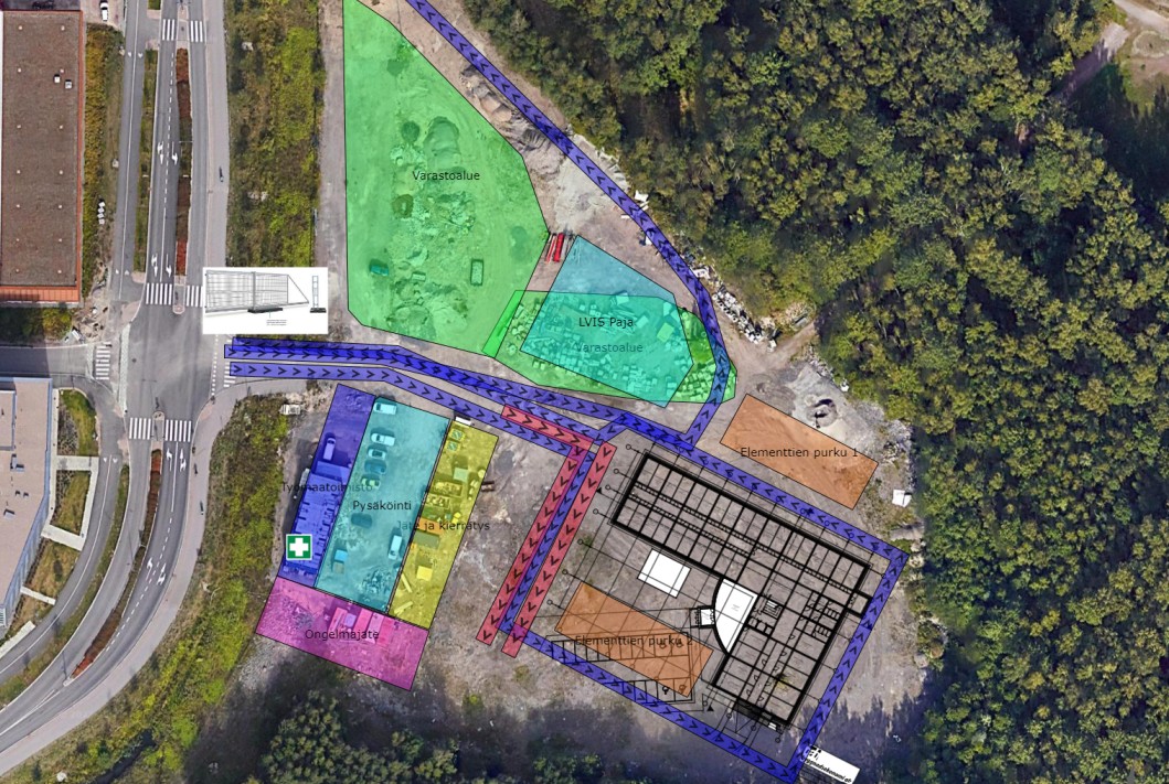
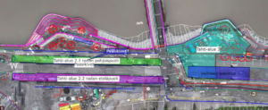
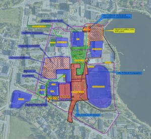
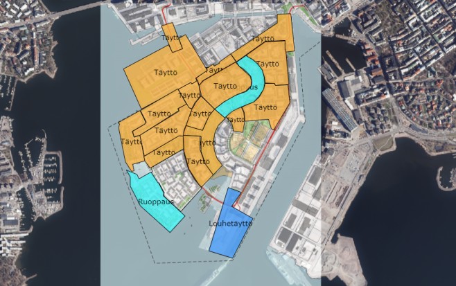
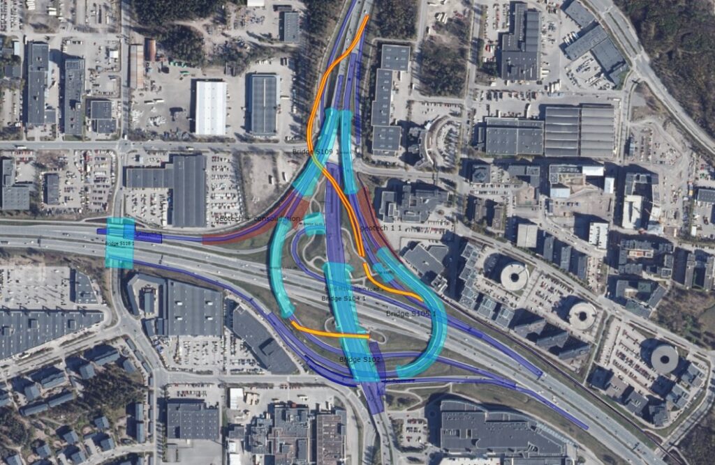
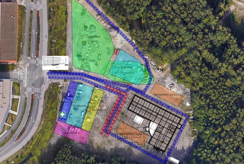
Map view
Map view in Zeitmaps project can be built from a variety of bulding blocks, which can be layered in highly customizable way. Building blocks of map view include:
Polygons & polylines
Text boxes (can contain images)
Markers
Tile maps (Google, OpenStreetMap, Bing, etc)
WMS/WMTS maps (satellite or drone images, etc)
Images/PDFs (can be easily georeferenced)
DXF files
Map elements are dynamic, so that changing playhead position on the timeline will affect the visibility and visual properties of the map elements. Get to know more detailed the features here.
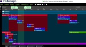
Presentations
Presentations can be created for Zeitmaps projects, and links to the presentations can be sent to the stakeholders, who can study the project schedule on their browsers by observing the dynamic map and interacting with the timeline. Viewing read-only presentations does not require logging into the application, and the viewer does not have write access to the project. See an example presentation.
The time interval of the presentation, the area of the view, the visibility of objects and other settings can be adjusted so that the presentation can show either the Gantt and the map views, both, or a customized view that allows specific information to be hidden from the presentation view.
Multiple presentation URL links can be created from a single Zeitmaps project. Presentation is a snapshot of a project state, and can be updated to reflect current project state when needed.
In playback & cycle mode presentations are great tool for public display / kiosk purposes.
Import & Export
Item timings or other Gantt data can be imported and exported in MS Project XML, Excel or CSV file formats, which helps to import a large amount of data using the most commonly used methods with other available time reporting tools or planning programs.
Export data from another software into your computer and import it the sheet into Zeitmaps with the push of a button. The program tells you the number of data records and maps it to the timeline you’ve specified.
Map view contents can be exported as PNG/PDF/DXF file.
The primary way for sharing project with stakeholders is to use presentations or invite them for joined workspace with a access URL link.
Pricing
Billing is monthly and per project or per user.
The license price for an individual user is €50, and €500 for unlimited users per project.
Order online here or contact us for more information.
FAQ
How does Zeitmaps’ integration of map views and Gantt charts streamline large-scale construction project scheduling?
By combining map views with Gantt charts, Zeitmaps provides a comprehensive visual tool that aligns project tasks with their geographical locations, enhancing the clarity and efficiency of scheduling and resource allocation.
In what ways does Zeitmaps facilitate the integration of data from Microsoft Project or Primavera into its system?
Zeitmaps supports importing and exporting data in formats compatible with Microsoft Project, Excel, and CSV, enabling seamless integration and synchronization of project schedules from these platforms.
How does Zeitmaps’ visual scheduling improve the coordination and communication among different construction site teams?
Visual scheduling in Zeitmaps allows teams to see task assignments, progress, and geographic locations in real-time, improving coordination by providing a clear, shared understanding of project timelines and responsibilities.
Can Zeitmaps manage complex schedules from multiple data sources, and how seamless is the import/export process?
Yes, Zeitmaps can manage complex schedules from multiple sources, with a seamless import/export process that supports MS Project, Excel, and CSV files, ensuring smooth data integration and updates.
What specific features does Zeitmaps offer that enhance real-time collaboration and information sharing among construction team members?
Zeitmaps offers features like real-time updates, dynamic presentations, and stakeholder involvement tools, enhancing collaboration by keeping all team members informed and engaged with the latest project information.
How does Zeitmaps assist in tracking project milestones and ensuring deadlines are met?
Zeitmaps tracks project milestones through its visual Gantt charts and real-time updates, ensuring deadlines are visible and easily monitored, helping teams stay on schedule.
Can you link tasks to specific geographic locations in Zeitmaps, and how does this feature enhance site management?
Yes, tasks can be linked to specific geographic locations, enhancing site management by providing a clear spatial overview of activities, facilitating better coordination and resource management on-site.
How does Zeitmaps provide access to project schedules for stakeholders without requiring additional software installations?
Zeitmaps offers web-based access, allowing stakeholders to view and interact with project schedules through a browser, eliminating the need for additional software installations.
What types of visual aids can be added to schedules in Zeitmaps to improve project comprehension and communication?
Zeitmaps allows the addition of visual aids such as images, maps, and diagrams to schedules, enhancing comprehension and communication by providing detailed visual context for project tasks and timelines.
How does Zeitmaps ensure real-time updates to construction schedules are accurately reflected and communicated to all team members?
Zeitmaps ensures real-time updates are accurately reflected through its cloud-based platform, which instantly synchronizes changes across all user devices, keeping all team members informed of the latest schedule modifications.
Contact us
How to fit your project into Zeitmaps, try it for free at zeitmaps.com or contact us and we’ll get your project started. If you need help getting started, how we could help in optimizing the project process, don’t hesitate to contact us, let’s have a brainstorming session together.

Marcus Bäck
+358 50 366 4747
marcus.back@zeitmaps.com

Johan Appelqvist
+358 50 466 0907
johan.appelqvist@zeitmaps.com

Juuso Mäkinen
+358 40 775 1469
juuso.makinen@zeitmaps.com

Tiina Klutas
+358 40 350 9278
tiina.klutas@zeitmaps.com

