Pirkkala campus project, located in Supanniitty, is a large-scale project in which Zeitmaps has been introduced to enhance spatial planning, scheduling and cooperation. Pirkkala municipality’s traffic engineer Joonas-Petteri Kallonen opened the project for us to get a deeper understanding of how they have integrated Zeitmaps into their daily operations and what experiences they have had with the Zeitmaps application.
Project complexity and collaboration
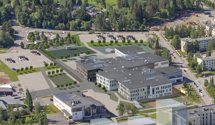
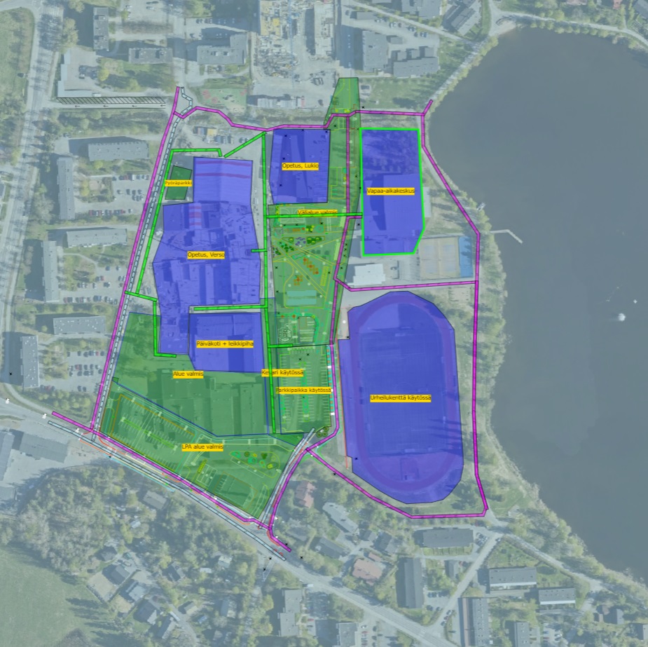
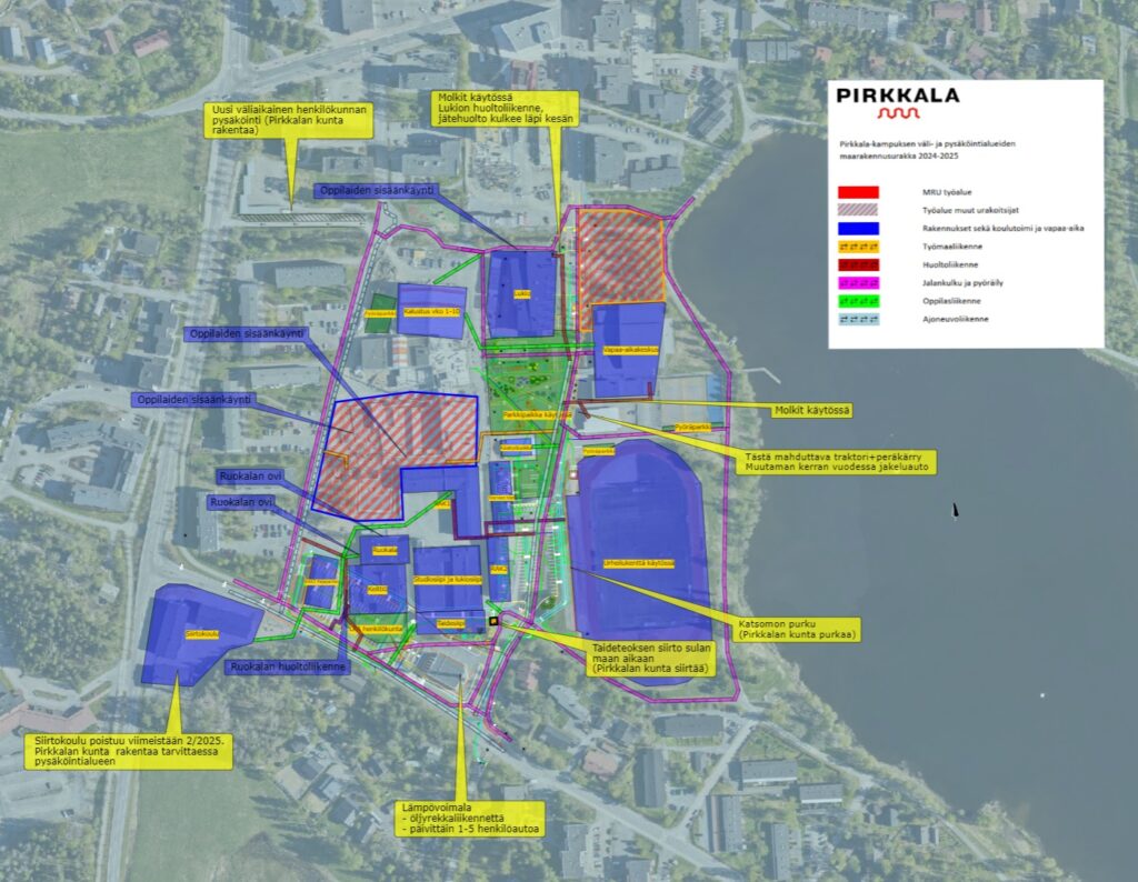
Pirkkala campus project is a complex project that includes several different parties and types of work. In place of the current school area and facility, a completely new campus area will be built with two school buildings which will provide facilities for approximately 1,700 elementary school students, preschoolers, early childhood education (e.g. nursery) and staff. The school center is also designed for evening and weekend activities for youth, associations and hobby activities.
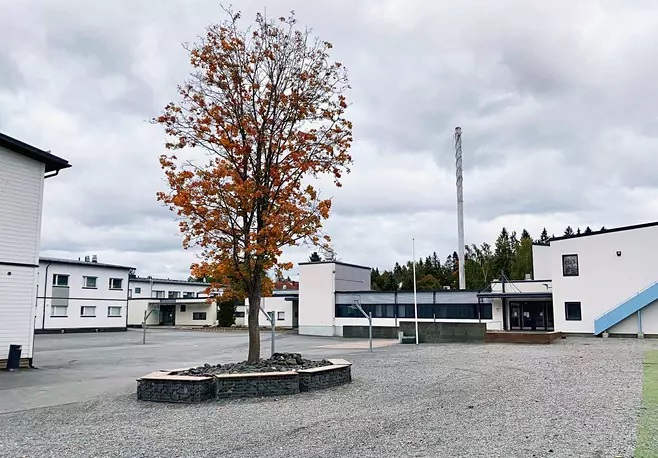
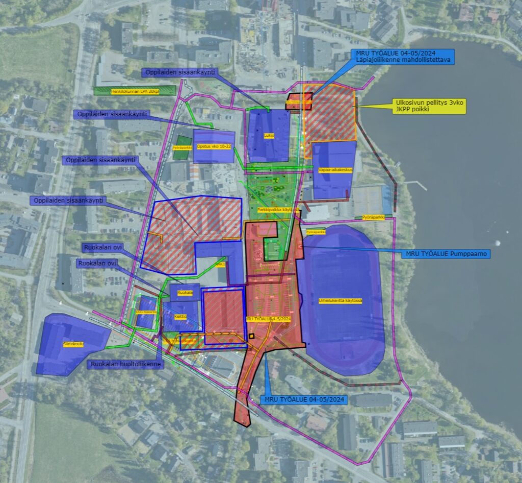
It is known to be the largest single construction project in the history of Pirkkala, which has been mapped by approximately 11 different operators from public and general transport, school staff, students, leisure center and extends to house builders, road, renovation and yard construction builders just to name a few. The project is challenged by the area’s active school and leisure facility activities in the middle of the ongoing construction site, as well as the public traffic in the area and an open use of the popular outdoor trail around Lake Vähäjärvi. In addition, the active use of the leisure center and sports field next to the campus during the entire project must be taken into account from planning to implementation.
Planning requires active coordination of school users, public transport, house builders, renovation operators and maintenance traffic, for which Zeitmaps has been a convenient solution for how each of the operators involved in the project can fit into the work areas without surprising schedule overlaps. Coordination also has an impact on the overall schedule in terms of project completion.
Zeitmaps has been a key tool for identifying areas and operators, mapping them, coordinating work schedules and enhancing cooperation. In particular, the users and builders of the school and the leisure center have benefited from the precise routes and descriptions of the areas.
While the length of the overall implementation of the construction project is estimated to last from year 2021 to 2025 and the total scope of the project area as a whole is approximately 19,500 brm2 for which Zeitmaps is operated in managing specific segments during the ongoing work in 2024-2025.
Frequency of use and strengths
Kallonen says that the use of Zeitmaps is weekly, and often even daily, in order to obtain materials and PDF files from various stakeholder sources for drawing up-to-date information or regional plans as the project progresses.
Kallonen emphasizes the easy browser-based nature of Zeitmaps and that separate installations on the computer are not needed, to use the web app. Zeimaps is open in the browser tab in the same way as other browser programs used daily.
Receiving and sharing
Although at the beginning there was reluctance to move from the PDF world into a browser-based system, Kallonen says that the use of Zeitmaps has spread positively in the organization. He has shared his experiences with his colleagues and seen interest in different sectors, such as regional planning department, water and wastewater engineering and landscaping department.
As the project progresses, there is once a month joint meeting about the campus project for all project affected stakeholders and operators. Using Zeitmaps, the current situation, future situations and information to be supplemented are added directly to Zeitmaps. The Zeitmaps presentation link is also distributed to all operators and stakeholders for information so that everyone can familiarize themselves with the plans and the upcoming situations.
Examples on the benefits
The use of Zeitmaps in the Pirkkala campus project has shown that the application is an effective tool for managing complex projects well before the actual project starts and especially during it.
The biggest benefit so far for Kallonen has been that the campus project has already identified the coordination challenges of the summer of 2025 and preliminary work area plans have been made where each operator are building and schedules on when to build.
During 2024, several precise weekly work phases were also planned and completed to Zeitmaps, where the completion of the tasks required the proper completion of the previous operator’s work before the next operator could start.
Kallonen does not see that in the traditional PDF world, it would have been possible to identify these compatibility risks in advance and to have been able to remove these risks in advance in such an efficient manner. Zeitmaps was brought as a new software into the middle of the working community and was made to work with a good cooperation. The potential of Zeitmaps as a collaboration enhancer and project planning tool is clearly visible.
Interviewee: Joonas-Petteri Kallonen, Pirkkala municipality’s traffic engineer. Author: Zeitmaps team.
Contact us for more information at zeitmaps.com/contact
Start the free usage of Zeitmaps at App.